


Hike or backpack a thirteen-mile adventure on this view-packed stretch of the Appalachian Trail, exploring Blood Mountain, Neel Gap, Wolf Laurel Top, and Cowrock Mountain.
(round trip)
difficult
friendly
LOCATION:Appalachian Trail near Hiawassee, Georgia
PACK:our Osprey day pack and our hiking gear list
OFFICIAL MAP: Appalachian Trail, Trails Illustrated Map (find it at Trailful Outdoor Co.)
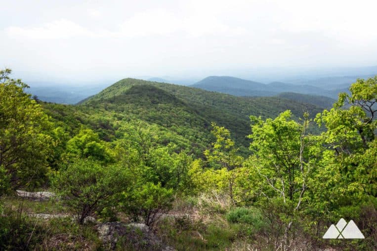
The Blood Mountain Wilderness is one of Georgia’s most popular destinations for outdoor adventure, offering awe-inspiring views from towering mountain summits and trails through lush forest speckled with rocky outcrops. This hike combines several of Blood Mountain’s most popular trails, trekking to the base of Blood Mountain from Neel Gap on the Byron Reece Trail before hiking the Appalachian Trail eastbound to stunning views from Cowrock Mountain.
This classic Georgia Appalachian Trail hike racks up 13 moderately difficult out-and-back miles, and scales multiple view-packed mountain summits, scoring views of nearby Yonah Mountain. It’s a fantastic, long day hike – and it’s an even better overnight backpacking trip, with many trailside camping options (including our favorite campsite at the Wolf Laurel Top summit). And if 13 miles doesn’t cut it, there’s more mountaintop beauty waiting at the Blood Mountain summit, a 3-mile addition to the hike from Flatrock Gap.

Blood Mountain to Cowrock Mountain: the hike
The adventure begins at the Byron Reece trailhead (view trail maps & directions), following the blue-blazed trail through a lush, mossy, creek-filled valley. The trail grabs elevation, ascending through a deciduous and rhododendron forest, following and crossing several small streams in a southwest-bound hike to the AT.
The Byron Reece Trail reaches the Appalachian Trail at .6 mile at Flatrock Gap. From the junction, the hike turns left to cross through Neel Gap, following the AT’s iconic, white rectangular trail blazes. (Or alternately, grab stunning views and visit the 1920s AT shelter at the Blood Mountain summit, turning right at Flatrock Gap to hike the Appalachian Trail westbound to Blood Mountain. This 1.5-mile out-and-back extension adds three miles to the total trip length, so you’ll bag 16 miles total.)

Departing Flatrock Gap, the Appalachian Trail descends from Blood Mountain’s lower elevations, passing a balanced stack of boulders at .75 mile. The hike crosses the paved highway through Neel Gap at 1.6 miles, reaching the historic stone Walasi-Yi Center.
Before following the AT’s iconic white blazes through a breezeway in the building, stop at Mountain Crossings, North Georgia’s renowned AT outfitter. Mountain Crossings is one of only a few outfitters located on right on the trail along its epic, 2000+ mile stretch from Georgia to Maine. Be sure to drop in; knowledgeable, friendly, and seasoned AT hikers staff the store.
Departing Neel Gap, the trail ascends steadily from the highway, leaving the buzz of civilization behind as it hikes eastbound towards Tesnatee Gap and enters the Raven Cliffs Wilderness. The trail continues its ascent, carving through switchbacks and passing trailside campsites in a 700+ foot climb to Levelland Mountain. The AT crests at the Levelland Mountain summit at 3.15 miles, catching views of the nearby rolling mountains.
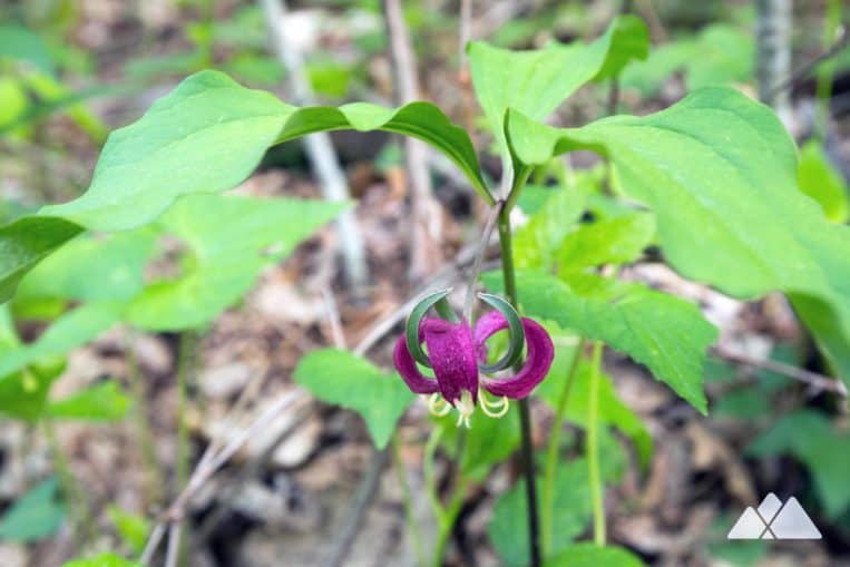
The Appalachian Trail descends Levelland Mountain, switching back in a descent towards Swain Gap. The trail rolls elevation over Turkypen Mountain and Rock Spring Top, passing trailside campsites on both sides of the trail. The hike follows a rolling ridgeline under a shady forest canopy, passing through a green, fern- and wildflower-filled forest.
The trail begins a steady ascent to Wolf Laurel Top Mountain at 4.25 miles, reaching the summit at 5.1 miles. A side trail departs trail right, looping to a prime campsite at the mountain’s summit – one of our favorite on the Appalachian Trail in Georgia. The views from the campsite are stunning, especially at daybreak, when the sun rises from the far horizon in a stunning, colorful sunrise.
The hike departs Wolf Laurel Top, descending to Baggs Creek Gap at 5.75 miles. The AT climbs from the gap, grabbing elevation in a final climb to the Cowrock Mountain summit. The hike catches views from a rocky clearing alongside the Appalachian Trail at 6.2 miles before reaching the Cowrock summit at 6.5 miles.
The summit offers stunning views of the surrounding mountainscape, notably more angular and pronounced than the rounded, rolling scene from Blood Mountain to the west. Yonah Mountain is visible on the near horizon, its sheer walls of nearly-bare rock towering skyward.
From the summit, the Appalachian Trail hikes .85 miles to a paved trailhead at Tesnatee Gap. This hike turns from the Cowrock Mountain summit, retracing the Appalachian Trail westbound toward Neel Gap and Blood Mountain. The hike scales Wolf Laurel Top and Levelland Mountains before crossing Neel Gap to return to the Byron Reece Trail. The hike turns right on the Byron Reece Trail at Flatrock Gap, descending to the trailhead and completing the hike at 13 miles (or 16 miles, with the Blood Mountain summit extension).

Backpacking and Camping
This stretch of the AT offers fantastic camping opportunities to backpackers willing to haul their gear over the hike’s many mountain ascents (free, first-come, first-camp). The Wolf Laurel Top site is our top pick, and one of our favorite backpacking campsites in Georgia. If that spot is already occupied, catch some dreams under the stars on the AT at one of the many other campsites on the trail – check out the trail map below for campsite locations.
This hike explores both the Blood Mountain Wilderness and the Raven Cliff Wilderness areas. Due to their popularity with hikers and backpackers, both of these wilderness areas have seen increased black bear activity at campsites in recent years. Storing food in bear-resistant canistersis required March 1 – June 1, and strongly suggested year-round. (Need one? We’ve got them in stock at our Trailful Outdoor Co. shop.) And campfires are prohibited year-round in the Blood Mountain Wilderness.

Please Remember
Always leave no trace, pack out everything you pack in, and if you see trash, pick it up and pack it out.
Stay on the marked trail, tell someone where you're going, pack safety and wayfinding essentials, and don't rely on a mobile phone to find your way. Please always practice good trail etiquette. And before you go, always check the trailhead kiosk, official maps, and the park or ranger office for notices of changed routes, trail closures, safety information, and restrictions.
Appalachian Trail Blood Mountain to Cowrock Mountain Map, Directions & Details

Love the trail?
This trail is maintained thanks to the hard work of countless volunteers and donations from supporters of the Georgia Appalachian Trail Club. Please support them by making a donation or joining a volunteer day. Let's work together to keep these fantastic trails maintained and open for use!
Driving Directions
Parking
Free (limited) parking is available at the Byron Reece trailhead.
GPS Coordinates
34.741433, -83.922850 // N34 44.486 W83 55.371
Elevation Profile


