


Explore Atlanta’s outdoor beauty, and hike our top 10 favorite Atlanta hiking trails within 40 miles of the city. These hikes explore gorgeous, rolling forest, scenic rivers, historical remains and catch the best, most stunning mountaintop views near Atlanta.
Spectacular hikes fill Georgia’s rolling mountains and coastal plains, offering a great outdoor escape from Atlanta’s urban life. Fueled with a hunger for fresh air, nature, and the chance to unplug from technology, we’ve trekked many of Georgia’s best trails, eager to find the best hikes to waterfalls, mountain summits, and mossy, whitewater-filled trout streams.
Many of the most popular Georgia hiking trails are less than two hours from Atlanta, including the famed Appalachian Trail and the beautiful waterfalls at Panther Creek Falls. But busy weekends don’t always allow time for a drive to the Appalachians and time on the trail. The local Atlanta area has many hiking trails that equal the adventure on the fantastic hiking trails in the North Georgia mountains. And some local Atlanta hikes provide scenery so visually stunning you’ll be left guessing if you’re even in Georgia, let alone an Atlanta suburb. These are our top ten favorite Atlanta hiking trails. All are within a 40-mile drive of Midtown Atlanta – and a few are even within the I-285 Perimeter loop.

Top places to hike near Atlanta: our favorite trails


Arabia Mountain Top Trail
1.3 miles
Explore a beautiful, diverse landscape at Arabia Mountain, located just 30 minutes from Midtown Atlanta. Explore Arabia Mountain’s scenic summit on this beginner- and kid-friendly adventure, catching views of Arabia Lake and abundant natural beauty. You’ll be close to Atlanta’s perimeter – but will feel seemingly worlds away.
VIEW TRAIL INFO & MAPS
Sawnee Mountain Indian Seats Trail
4 miles
The Indian Seats Trail climbs the summit of Sawnee Mountain, catching beautiful summit views of the North Georgia mountains. The hike climbs to a lofty, view-packed summit, offering far-reaching views to the southern Blue Ridge range on the far horizon.
VIEW TRAIL INFO & MAPS
Sweetwater Creek State Park
2 – 4 miles
Explore rugged outdoor beauty minutes from Atlanta on the rocky, boulder-lined banks of Sweetwater Creek State Park. Hike our favorite Sweetwater Creek trails through sun-dappled forest, and then follow the sandy and bluff-filled banks of Sweetwater Creek to explore Civil War mill ruins, tumbling whitewater and small waterfalls.
VIEW TRAIL INFO & MAPS
Sope Creek Trail
1.5 miles
Hike the Sope Creek Trail at Sope Creek Park, one of the most popular (and scenic) parks in Atlanta’s Chattahoochee River National Recreation Area. The trail meanders through a young forest to a rushing, boulder-filled creek, and explores Civil War paper mill ruins before circling the banks of a glassy pond.
VIEW TRAIL INFO & MAPS
East Palisades Trail at the Chattahoochee River
3.4 miles
Hike the East Palisades Trail at Indian Trail and Whitewater Creek to some the most scenic Chattahoochee River views in the Atlanta area. The East Palisades Trail follows the banks of the shoaling Chattahoochee River, hikes through a bamboo forest, and scales several large bluffs to stunning overlook views of the river.
VIEW TRAIL INFO & MAPS
Pine Mountain Trail near Allatoona Lake
4.5 miles
Hike the Pine Mountain Trail near Cartersville through a rocky coniferous forest to views at the Pine Mountain summit, grabbing stunning long-range views of Lake Allatoona and the Atlanta skyline on a clear day.
VIEW TRAIL INFO & MAPS
Kennesaw Mountain Trails
1.3 – 11 miles
Hike the enormous trail network at Kennesaw Mountain National Battlefield to explore stunning Atlanta skyline views and terrain drenched in Civil War history. Climb the double peaks of Kennesaw Mountain, explore the grassy expanses and rocky terrain at Pigeon Hill and Cheatham Hill, and hike through a stream-filled forest. Civil War artifacts and monuments pepper the trails’ length, offering an Atlanta history lesson alongside abundant natural beauty.
VIEW TRAIL INFO & MAPS
Stone Mountain Cherokee and Walk-up Trails
6.8 miles
Combine Stone Mountain’s Cherokee and Walk Up Trails for a hike through the most popular, scenic, and serene sections of Stone Mountain Park. This hike summits the mountain, catching stunning Atlanta skyline views before climbing over, down, and around the circumference of Stone Mountain’s massive granite face.
VIEW TRAIL INFO & MAPS
Vickery Creek Trail at Roswell Mill
3 miles
Hike the Vickery Creek Trail to the historic mill ruins at Roswell Mill in Atlanta’s Chattahoochee River National Recreation Area. The trail also visits a covered bridge and a rushing, cascading waterfall at the historic Vickery Creek dam.
VIEW TRAIL INFO & MAPS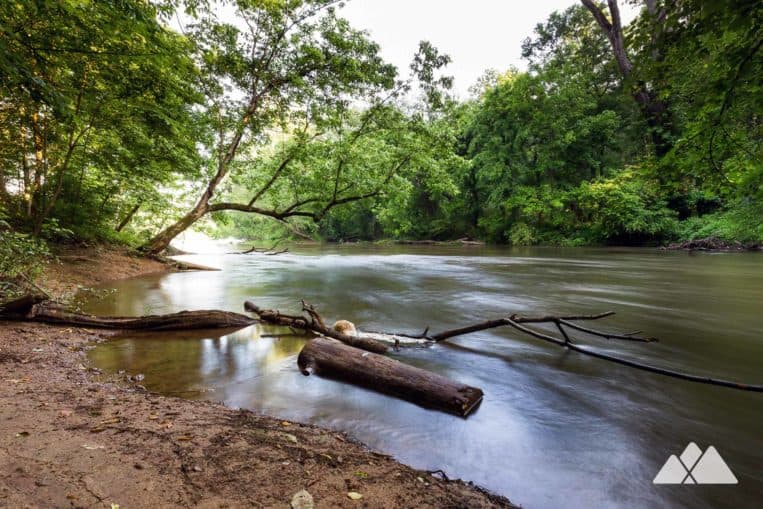
Powers Island Trail at the Chattahoochee River
2.4 miles
The Powers Island Park is so much more than overflow parking for its popular neighbor, the Cochran Shoals Trail. Hike across the park’s bridge to trek through an old-growth riverine forest on Powers Island and loop down the Chattahoochee River for views from its boulder-filled banks.
VIEW TRAIL INFO & MAPS
What to pack?
Our favorite hiking gear
Ready to hit the trail, but wondering what to pack? Our hiking gear list features our favorite, trail-tested hiking gear for day hikes on local trails and in the Georgia backcountry. We print and stitch our Atlanta Trails shirts and hats locally in Atlanta and Asheville, and they’re our favorite for trail adventures all over the South. And no matter what you pack in, pack it all back out. Please leave no trace and help preserve Georgia’s beauty.
OUR HIKING GEAR LIST


More great outdoor adventures near Atlanta
Escape sidewalks and crosswalks on our top ten Atlanta running trails – they’re equally great for walking or a weekend stroll with the family. Visit Georgia’s rolling southern Appalachian mountains on a hike to a stunning summit in our list of top ten hikes in North Georgia. Love waterfalls? Hike to our favorite falls on our top ten list of Georgia waterfall hikes. Up for a road trip? Hike to some seriously epic views from some of the tallest mountains east of the Mississippi River on our favorite Asheville hiking trails, all within 40 miles of North Carolina’s favorite mountain town.

Please Remember
Always leave no trace, pack out everything you pack in, and if you see trash, pick it up and pack it out.
Stay on the marked trail, tell someone where you're going, pack safety and wayfinding essentials, and don't rely on a mobile phone to find your way. Please always practice good trail etiquette. And before you go, always check the trailhead kiosk, official maps, and the park or ranger office for notices of changed routes, trail closures, safety information, and restrictions.


