


Hike through beautifully sculpted rock formations at Rocktown, one of Georgia’s most popular bouldering destinations, on the summit of Pigeon Mountain.
(round trip)
moderate
friendly
LOCATION:south of Cloudland Canyon State Park
PACK:our Osprey day pack and our hiking gear list
Nestled in the middle of the enormous Crockford-Pigeon Mountain Wildlife Management Area, the Rocktown Trail is easily one of the most popular hikes in the area. Although this hike is scenic in its own unique way, it is most popular in the climbing community as one of the most diverse bouldering destinations in the South. The trail’s unique 200 million-year-old rock formations make this a great spot to explore.

Note: A Georgia hunting license, fishing license, or a Lands Pass is required. Licenses are not available onsite; be sure to obtain your license before your hike. And these trails close during specific hunting seasons; check the Crockford-Pigeon Mountain site for information on hunting season dates and closures.

Pigeon Mountain: the hike
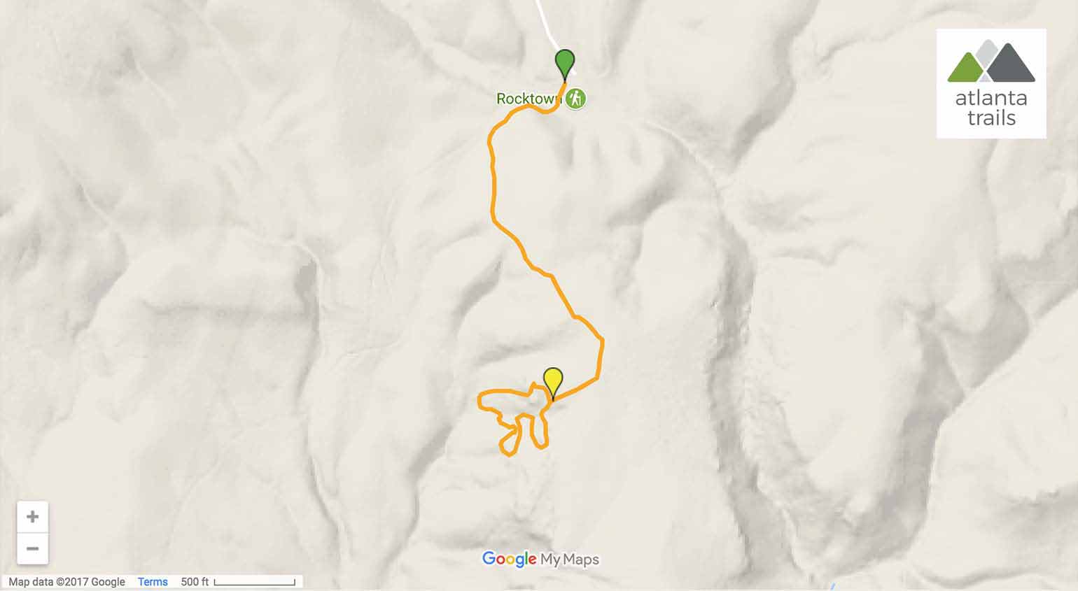
The hike starts from the Rocktown Trailhead (view maps and driving directions). A short distance into the hike, the trail crosses a small wooden bridge crossing over a narrow stream. After the bridge crossing, there is very little elevation gain, making this a very easy hike as the trail follows the top of the ridge on Pigeon Mountain. Oak, maple, and pine trees surround the trail as it winds through the forest.
At a half mile, large boulders begin to flank the right side of the trail. The trail veers towards the southeast before reaching the main section of the rock field. A massive, 30-foot tall boulder with a deep over-hang immediately gives the impression of just how unique this landscape is. Once this section of the trail is reached, the trail becomes less obvious, but can be done as a ‘lollipop’ or loop trail to explore most of Rocktown. Boulders ranging from 6 feet to 50 feet dot the landscape, providing a diverse array of routes for people to test their climbing skills.

The bouldering in Rocktown has a wide variety of routes, with many routes yet to be named or discovered. The well-known routes have difficulties ranging from V0 all the way up to V9+. Please note that rock climbing and bouldering is dangerous, so please take all necessary safety precautions and inform yourself of the associated risks.

One of the great things about this hike is that you don’t need to be a climber to enjoy the incredible rock formations that Rocktown has to offer. From a geology standpoint, the boulders are very interesting, as they were formed when the ocean covered this landscape over 200 million years ago. As the water receded, the more porous limestone eroded, exposing more resilient sandstone formations with a variety of patterns and textures. Some of the boulders are smooth and flat, while others more closely resemble the skin of a reptile. The scattered boulders also provide a great opportunity to have a picnic or just wander around and explore the narrow passages between the steep sandstone walls.
After following the vague loop, which navigates through the boulder field, the main section of trail can be located on the backside of the large 30-foot overhang boulder. The return hike doubles back to the parking area in a gentle decline, reaching the trailhead at just over 1.6 miles.

More hike-worthy adventures near Pigeon Mountain
The landscapes of Northwest Georgia and Southeast Tennesee are incredibly scenic and one of our favorite areas to find adventure in the South. Hike to incredible canyon views and tumbling waterfalls at Cloudland Canyon. Follow the lofty elevations of Lookout Mountain to stunning views of the Tennessee River and downtown Chattanooga at Sunset Rock. Visit the exceptionally beautiful waterfalls at Lula Lake Land Trust. Scramble through a waterfall and boulder-filled valley on the Fiery Gizzard Trail, climbing to beautiful views at Raven Point. And check out our full list of top hikes near Chattanooga for even more adventure inspiration.

Please Remember
Always leave no trace, pack out everything you pack in, and if you see trash, pick it up and pack it out.
Stay on the marked trail, tell someone where you're going, pack safety and wayfinding essentials, and don't rely on a mobile phone to find your way. Please always practice good trail etiquette. And before you go, always check the trailhead kiosk, official maps, and the park or ranger office for notices of changed routes, trail closures, safety information, and restrictions.
Rocktown Trail at Pigeon Mountain Map, Directions & Details
Love the trail?
This trail is maintained thanks to the hard work of countless volunteers and donations from supporters of the Chattahoochee National Forest. Please support them by making a donation or joining a volunteer day. Let's work together to keep these fantastic trails maintained and open for use!
Driving Directions
Parking
A Georgia Fishing, Hunting, or Lands Pass is required. The trail is closed to hikers and climbers on specific hunting dates on Pigeon Mountain.
GPS Coordinates
34.658817, -85.389917 // N34 39.529 W85 23.395
Elevation Profile


