


Run a scenic two miles in Tanyard Creek Park, following a paved stretch of the Atlanta BeltLine Northside Trail and tunneling under a towering train trestle.
(round trip)
paved
friendly
LOCATION:Collier Hills in Atlanta, Georgia
PACK:our Osprey day pack and our hiking gear list
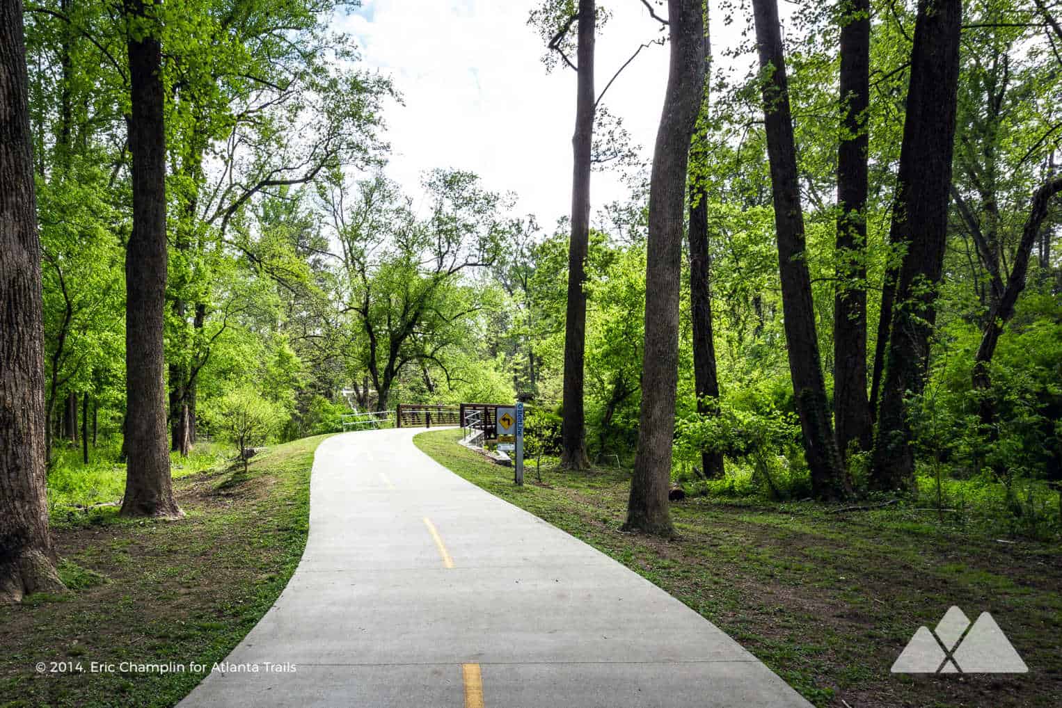
Sun-dappled forests, a towering train trestle, a pebble-lined creek and wide, grassy meadows: there’s a whole lot of scenic beauty to be seen at Tanyard Creek Park. A paved stretch of the Atlanta BeltLine meanders through the park, winding gently through the park’s most scenic stretches and ducking under an enormous wooden train tower. The Northside BeltLine Trail is an equally a great venue for an in-town run, or a great mid-week stroll with the family dog.

This run totals two miles, round trip, winding through a creek-filled forest and crossing multiple bridges on a wide, paved, level trail. While its length isn’t as long as the Eastside Trail, this stretch of Atlanta’s well-loved 22-mile trail project explores some incredibly beautiful scenery in a quiet residential neighborhood. It’s pretty much the perfect spot for a moderately short run, without the usual crowds and trail traffic of the other stretches of the BeltLine.

Tanyard Creek Park: the run
The run begins at the Tanyard Creek Park trailhead off Collier Road, located in Atlanta’s beautiful Collier Hills neighborhood just off of Peachtree Street (view maps and driving directions). From the parking area, the run drops down a series of stairs and landings before turning right, running south. The wide, paved trail winds along the scenic Tanyard Creek, passing a large playground area before crossing the creek over a metal and concrete bridge. A broad, grassy meadow lies on the trail’s right side, the perfect venue for a post-run stretch. The trail passes under a wooden canopy beneath a 30-foot-tall wooden railway structure at just under a half mile.

The run reaches a paved neighborhood access trail at .45 mile, turning to retrace its steps toward the Collier Road trailhead. The paved trail runs nearly level over its course, with very gradual elevation changes. Looking for a run that escapes Atlanta’s usually hilly terrain? This is your trail!
Passing the trailhead, the run ducks under the Collier Road bridge, passing a vibrant mural. The Northside Trail’s northern half meanders under a tall forest canopy, catching dappled sunlight and arcing through the urban forest. The trail continues to flank Tanyard Creek, crossing the creek over a large concrete and metal bridge at 1 mile.
The trail exits the shady canopy, running beside Bobby Jones Golf Course, passing through a residential neighborhood, and reaching its northern trailhead at 1.3 miles. The run turns here, retracing its outbound steps to the trailhead and completing the run at 2 miles.
While it’s not the longest paved running trail in Atlanta, it’s undoubtedly one of the most scenic. And an out-and-back run on the trail racks up 2 miles without traffic or road crossings, making it a favorite for local Atlanta runners. Up for more mileage? It’s worth a repeat or two!

More of our favorite Atlanta running trails
Looking to add some scenery to your running routine? Follow our top ten Atlanta running trails through some of our city’s most beautiful parks and urban forests. Our favorite trails on the Chattahoochee River are our go-to spots for a long run, following the banks of the wide-flowing Hooch in metro ATL. And check out our full list of Atlanta running trails for more than 30 of our favorite spots to grab a great workout with a scenic backdrop.

Please Remember
Always leave no trace, pack out everything you pack in, and if you see trash, pick it up and pack it out.
Stay on the marked trail, tell someone where you're going, pack safety and wayfinding essentials, and don't rely on a mobile phone to find your way. Please always practice good trail etiquette. And before you go, always check the trailhead kiosk, official maps, and the park or ranger office for notices of changed routes, trail closures, safety information, and restrictions.
Tanyard Creek Park Map, Directions & Details

Love the trail?
This trail is maintained thanks to the hard work of countless volunteers and donations from supporters of Park Pride. Please support them by making a donation or joining a volunteer day. Let's work together to keep these fantastic trails maintained and open for use!
Driving Directions
Parking
Free.
GPS Coordinates
33.810600, -84.403067 // N33 48.636 W84 24.184
Elevation Profile


