


Hike the Sope Creek Trail to the ruins of a stacked-stone Civil War-era paper mill on the banks of a rocky creek, and then loop to a serene pond in a scenic Chattahoochee River park in Atlanta.
(round trip)
moderate
friendly
LOCATION:Chattahoochee River in metro Atlanta, Georgia
PACK:our Osprey day pack and our hiking gear list
Tucked into a high-end neighborhood just outside Atlanta, Sope Creek Park offers over three miles of scenic hiking, mountain biking, and running trails. The park’s extensive network of trails explore the stone ruins of a paper mill destroyed by Union troops during the Civil War, now standing in multi-story, castle-like ruins.
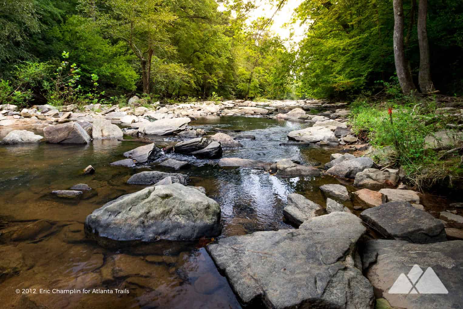
Alongside the paper mill ruins, Sope Creek flows broad and shallow, coursing through angular shoals under a canopy of trees towards the wide Chattahoochee River downstream. And there’s a large, glassy pond near the trailhead that offers tranquil views and, in warm-weather months, abundant wildflowers along its banks.
Sope Creek Park is one of many parks in the Chattahoochee River National Recreation Area – a network of fantastic parks and hiking trails on the Chattahoochee River in Metro Atlanta. Compared to other parks in the Chattahoochee River NRA like the ultra-popular Cochran Shoals Trail, Sope Creek is usually less crowded, offering a quiet, local escape from Atlanta’s whirlwind of traffic, noise, and concrete. This scenic loop explores the park’s highlights, visiting the paper mill ruins on both sides of Sope’s rocky creek bed before looping to the placid waters of Sibley Pond.

Sope Creek Trail: the hike
The hike departs from the Sope Creek trailhead (see the trail maps and driving directions), traveling east and dropping elevation through a young hardwood forest. Sope Creek Park offers an extensive trail network, and numbered signposts and maps at each major trail intersection help with wayfinding through the park’s maze of trails. From the trailhead, this hike travels eastbound to signposts SC3 and SC4, and then drops to the paper mill ruins at SC27. The hike reaches the towering 19th-century mill ruins at just under .5 mile.

The mill was built in 1855 and was destroyed by Union troops during the Civil War, targeted for its role in paper production used for Confederate currency. The remnants of the foundation and walls stand, cathedral-like, beside Sope Creek, and a small spillway waterfall tumbles beside the stone ruins. Following the paths around the ruins, the hike reaches the creek’s banks and begins following the creek’s flow downstream, hiking southeast and away from the bridge. The creek tumbles over strewn angular boulders, flowing past the 19th-century paper mill ruins. Colorful wildflowers line the creek’s banks, stretching tall to reach the sunlight streaming through the leafy canopy above.

Before reaching a side creek that flows from Sibley Pond, the hike skips over the creek’s rocky, angular bed to visit the foundation and ruins of a second mill building on the opposite bank.
The hike crosses back to the creek’s western banks, following a small tributary creek uphill to signpost SC6. The hike turns left at SC6, crossing the creek via stepping stones and winding through the shady forest to SC7 and SC13. Reaching SC13, the hike hangs a right, traveling westbound to the banks of Sibley Pond.

The pond is often unusually clear: peer quietly from the shore to glimpse its inhabitants, including turtles and large fish. The hike follows the paths around Sibley Pond to SC17 and SC15, making a loop around its grassy, wildflower-lined shore. At SC15, this hike turns left, hiking northwest to the Sope Creek trailhead, and completing the adventure at 1.5 miles.

More Sope Creek hiking adventures
Up for some more mileage at the park, and a high-mileage intown hike? Sope Creek’s network of trails connect to the popular Cochran Shoals Trail on the Chattahoochee River. Check out our Cochran Shoals to Sope Creek trail review for more info and maps for this 8.5-mile adventure that visits Sope Creek’s ruins, the banks of the wide-flowing ‘Hooch, and a small, historic cemetery between the two parks.

Please Remember
Always leave no trace, pack out everything you pack in, and if you see trash, pick it up and pack it out.
Stay on the marked trail, tell someone where you're going, pack safety and wayfinding essentials, and don't rely on a mobile phone to find your way. Please always practice good trail etiquette. And before you go, always check the trailhead kiosk, official maps, and the park or ranger office for notices of changed routes, trail closures, safety information, and restrictions.
Sope Creek Trail at Sope Creek Park Map, Directions & Details

Love the trail?
This trail is maintained thanks to the hard work of countless volunteers and donations from supporters of the Chattahoochee National Park Conservancy. Please support them by making a donation or joining a volunteer day. Let's work together to keep these fantastic trails maintained and open for use!
Driving Directions
Parking
$5 day pass, or included with a Chattahoochee River NRA annual pass
GPS Coordinates
33.937600, -84.44300 // N33 56.256 W84 26.580
Elevation Profile


