Hike Skidaway Island near Savannah to sweeping intercoastal views from an observation tower, to a prohibition-era liquor still, and through beautiful moss-draped coastal forest on the Big Ferry Trail.
(round trip)
moderate
friendly
LOCATION:Skidaway Island State Park near Savannah, Georgia
PACK:our Osprey day pack and our hiking gear list
Skidaway Island State Park’s popular campgrounds and cabins, beautiful maritime forest, and proximity to historic Savannah make this Georgia State Park a must-visit. View-packed, moderately easy hiking and biking trails weave and wind over the island’s sandy terrain, offering stunning coastal views under a canopy of gnarled, twisted trees draped in tendrils of Spanish moss.
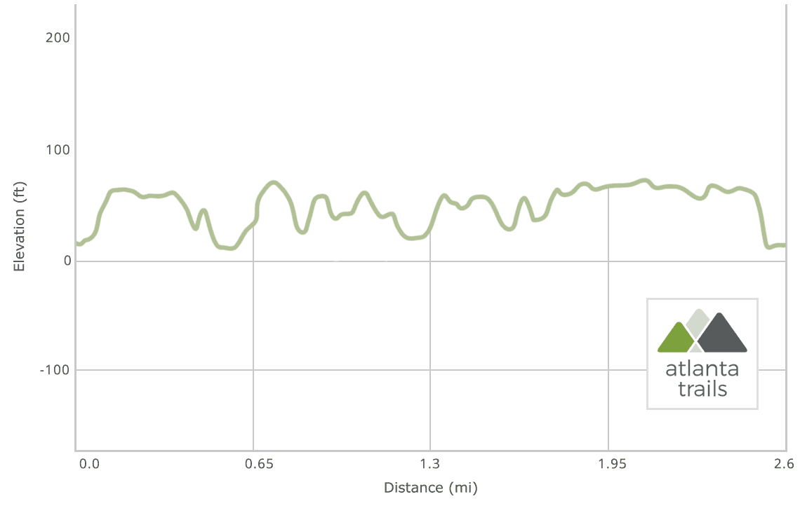
The park’s trails run nearly level, exploring a forest filled with gnarly-branched live oak, palm and pine trees, all covered with long, draped tendrils of Spanish moss. Vibrant green, fan-leafed saw palmetto plants cover the sun-dappled forest floor. This beginner-friendly hike travels to sweeping views of grassy, marshy waterways and explores several historic areas. It’s an equally great hike (or trail run) for families, history buffs, and anyone looking to grab some incredible views of coastal Georgia.

Skidaway Island Big Ferry Trail: the hike
Departing from the trailhead (view maps and driving directions), the trail ventures northwest into a marshy forest. Small ponds dot the sides of the trail as it hikes toward the Skidaway Narrows intercoastal waterway. Golden sunlight streams through the forest canopy above and catches in the Spanish moss that drapes the trees. The route passes a trail intersection at .25 mile, continuing northwest toward the river (and hiking the trail’s loop in a clockwise direction for the best views early in the hike).
The trail reaches a boardwalk at .5 mile, walking the boardwalk to a wooden observation tower for some of the best, sweeping views at the park. The tower’s panoramic views are wide and stunning, spanning the salt flats and marsh that border the Skidaway Narrows.

Departing the observation tower, the trail arcs to the east, diving deeper into the forest dense with palm, pine, gnarled oak and leafy, fan-shaped saw palmetto plants. Views of grassy marsh break through the tree line on the left.
The hike reaches an intersection at 1.15 miles, veering left and hiking northbound to the trail’s northern loop. The trail reaches a second junction at 1.2 miles, veering left. The path travels between mounded earthworks dug by Confederate soldiers during the Civil War to help defend Savannah. The forest here is particularly beautiful: Spanish moss drapes thickly through the canopy, densely covering trees and littering the trail.
Completing the trail’s northern loop, the hike veers left on the liquor still loop trail at 1.6 miles to view the rusted remains of several prohibition-era moonshine stills. In the 1930s, the island was a venue for the illegal manufacturing of liquor, thanks to its remote, secluded location.

Departing the moonshine stills, the hike treks southbound toward the Big Ferry Trail’s southern loop, veering left at 1.8 miles. The route meanders through a water-stippled forest before reaching the end of the loop at 2.4 miles, turning left to return to the trailhead and completing the adventure.
Skidaway Island cabins, camping and more trail adventures
Skidaway Island State Park’s proximity to historic Savannah and abundant options for outdoor adventure make it a great multi-night destination. Overnight at one of many campsites or the park’s new Camper Cabins, air-conditioned mini cabins with a kitchen, full bath, master bedroom and a sleeping loft.
Staying overnight, or have daylight and energy left to burn? Hike the southern stretches of the island on the Skidaway Island Sandpiper Trail and Avian Loop, crossing boardwalks and bridges to two islands and more stunning coastal views.
Please Remember
Always leave no trace, pack out everything you pack in, and if you see trash, pick it up and pack it out.
Stay on the marked trail, tell someone where you're going, pack safety and wayfinding essentials, and don't rely on a mobile phone to find your way. Please always practice good trail etiquette. And before you go, always check the trailhead kiosk, official maps, and the park or ranger office for notices of changed routes, trail closures, safety information, and restrictions.
Love the trail?
This trail is maintained thanks to the hard work of countless volunteers and donations from supporters of the Friends of Georgia State Parks. Please support them by making a donation or joining a volunteer day. Let's work together to keep these fantastic trails maintained and open for use!
Driving Directions
Parking
$5
GPS Coordinates
31.954143, -81.050040 // N31 57.233 W81 03.004
Elevation Profile


