


Rack up some distance and sleep under the stars on our top twelve backpacking adventures in Georgia, all perfect for an overnight adventure.
Georgia’s remarkable terrain is diverse, and our state is home to many miles of great backpacking and hiking trails. From remote barrier islands and grassy marshes to high, domed mountain summits and deep-carved canyons, Georgia offers a nearly endless bucket list worthy of a great hike. And with long-range trails like the epic-length Appalachian Trail and Bartram Trail winding through our state, Georgia offers a ton of fantastic opportunities for a great long-distance hike. Add in our mild climate that makes for perfect camping weather in all but our hottest months, and you’ve got the makings of a great backpacking adventure.
While we’re fans of great Georgia day hikes to picnic-worthy waterfalls and view-packed urban hiking trails in metro Atlanta, we also love to go deep. Deep into remote stretches of Georgia wilderness, far from cell phone signals and traffic noise. Deep into the wilds of sun-drenched, sandy islands where wild horses roam free. Deep into waterfall-filled valleys, and deep, following Georgia’s most scenic Appalachian Trail segments to view-packed mountain summits and rhododendron-filled stream valleys.

Our favorite backpacking trips in Georgia
With Georgia’s vast long-distance trail networks, it’s definitely hard to choose just a handful of favorites. Check out our full list of Georgia hikes over six miles for more long-distance trail adventures. And where ever your adventures take you, please remember to leave no trace to help preserve Georgia’s beautiful wilderness areas.


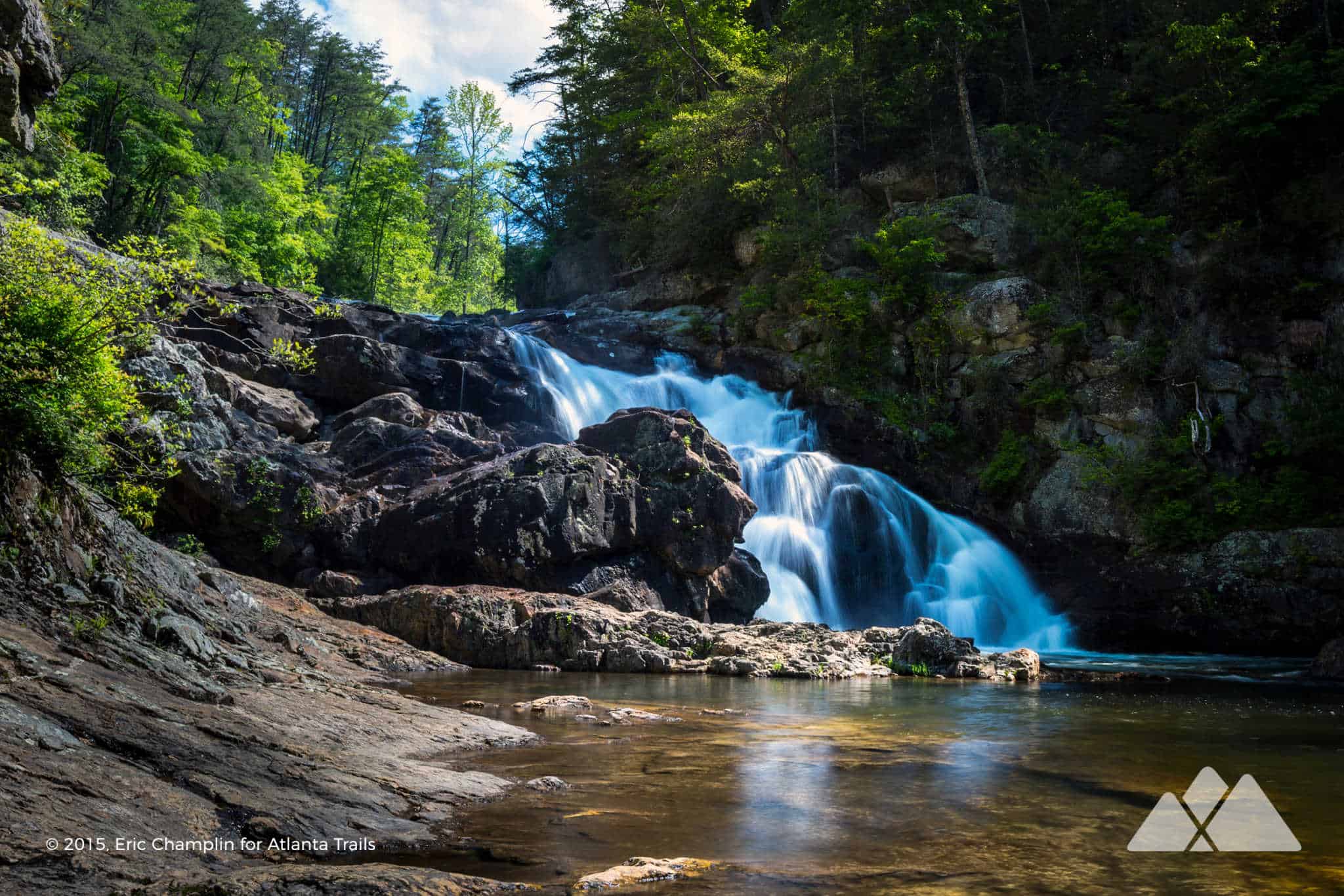
Appalachian Trail Approach Trail
Amicalola Falls to Springer Mountain
15.5 miles, round trip
While the Appalachian Trail’s official northbound start lies at the Springer Mountain summit, many AT thru-hikers begin their epic, 2000+ mile journey to Maine on the AT Approach Trail from Amicalola Falls. This 15.5-miler departs the towering waterfall at Amicalola Falls, rolling elevation through beautiful North Georgia wilderness before reaching Springer Mountain, where summit views abound. A metal vault hides a trail log that’s signed by thru-hikers starting (or ending) their epic adventure. Campsites dot the Approach Trail’s length, and there are some just past the Springer Mountain summit, too.
VIEW TRAIL INFO & MAPS
Cohutta Wilderness
Conasauga River Trail
13.2 miles, round trip
The Cohutta Wilderness is lush, green, remote, and incredibly beautiful. This adventure explores some of the most beautiful stretches in the wilderness, following the Conasauga River north from its southern trailhead at Betty Gap. The hike splashes through 36 river crossings and many creek crossings on this route, making this a great adventure for Georgia’s warm-weather months. And plenty of trailside campsites offer a great mid-hike place to drop a tent and stay the night, surrounded by the Cohutta’s beauty.
VIEW TRAIL INFO & MAPS
Cumberland Island National Seashore
Backpacking Cumberland Island
7 – 20 miles, round trip
Sandy hiking and backpacking trails explore Cumberland Island, visiting ruins of Carnegie family mansions, a forest filled with moss-draped gnarled trees, and miles and miles of quiet coastline. Reserve a backcountry campsite to overnight on the island, and catch some early morning serenity on powdery-sand beaches before the first tour boats arrive. Your only companions for miles will likely be the island’s herds of wild horses.
VIEW TRAIL INFO & MAPS
Cohutta Wilderness
Jacks River Trail
9 – 18 miles, round trip
Explore a lush forest covered in vibrant green moss and packed with tumbling waterfalls on the Jacks River Trail in the Cohutta Wilderness. Like the Conasauga River Trail, this adventure on the crystal-clear Jacks River plunges though a ton of river and creek crossings, making it a great summertime adventure. Follow the JRT from Dally Gap, deep in the Cohutta Wilderness, or hike to the tumbling Jacks River Falls on the Beech Bottom Trail. (Whichever route you choose, camping is restricted in the area immediately surrounding Jacks River Falls.)
VIEW TRAIL INFO & MAPS
Appalachian Trail
Unicoi Gap to Tray Mountain
9.9 miles, round trip
It’s one of the toughest stretches of the Appalachian Trail in Georgia, but stunning views from two mountaintops along this route make the workout so worthwhile. Hike from Unicoi Gap just north of the Alpine town of Helen, climbing to the rocky summit of Rocky Mountain before dropping through dense rhododendron tunnels to Indian Grave Gap. And then follow the Appalachian Trail on a second ascent to Tray Mountain, catching beautiful views of nearby Yonah Mountain.
VIEW TRAIL INFO & MAPS
Appalachian Trail
Three Forks to Springer Mountain
8.6 miles, round trip
It’s one of our all-time favorite backpacking routes on the Appalachian Trail in Georgia. This adventure begins in the lush stream-filled valley of Three Forks, hiking through dense rhododendron groves and crossing tumbling trout streams filled with weathered boulders and small waterfalls. The hike climbs to the rocky summit of Springer Mountain, reaching the southernmost end of the Appalachian Trail before returning to the trailhead. Numerous campsites at Three Forks and throughout the route make for a great place to camp and enjoy this classic stretch of North Georgia forest.
VIEW TRAIL INFO & MAPS
Brasstown Bald
Arkaquah Trail at Brasstown Bald
11 miles, round trip
This 11-mile adventure travels a ridge line from Brasstown Bald, Georgia’s highest-elevation summit. The hike catches views from multiple summits along the ridge, rolling elevation through a beautiful forest. Before doubling back on the outbound trail to the Brasstown Bald trailhead, the Arkaquah Trail dips elevation to visit Track Rock Gap, the site of ancient Native American petroglyph rock carvings. The catch? The climb back up to the ridge from the gap will leave you breathless, but the hike’s views and archeology are worth the workout.
VIEW TRAIL INFO & MAPS
Appalachian Trail
Blood Mountain to Cowrock Mountain
16 miles, round trip
Love stunning summit views? This Georgia Appalachian Trail section is a must-hike. The hike climbs from Neel Gap to catch beautiful views from the Blood Mountain summit, the highest Georgia peak on the Appalachian Trail. After doubling back through Neel Gap, the hike rolls elevation on the AT, catching more peak time on the sun-drenched summits of Wolf Laurel Top and Cowrock Mountain. With trailside campsites throughout its length, it’s an epic 16-miler day hike or an equally great overnight backpacking adventure.
VIEW TRAIL INFO & MAPS
Appalachian Trail
Woody Gap to Preachers Rock and Jarrard Gap
11.6 miles, round trip
This classic Georgia Appalachian Trail hike skips straight to stunning views, catching a beautiful sunrise view from the Woody Gap trailhead before even starting the hike. The hike trails northbound on the AT, visiting the bald summit of Preachers Rock at Big Cedar Mountain before trailing through a wildflower and fern-filled wilderness to Jarrard Gap. Pack your tent or ENO hammock: campsites are plentiful.
VIEW TRAIL INFO & MAPS
Fort Mountain State Park
Fort Mountain Gahuti Trail
8.2 miles, round trip
The Gahuti Trail scores a spot as our favorite over-7-miler in a Georgia State Park. This trail rings the summit of Fort Mountain, grabbing stunning, long-range views from multiple overlooks and trailing through beautiful forest to a waterfall. A must-follow side trail to the Fort Mountain summit adds a bit more distance, visiting a castle-like rock tower and a long, mysterious serpentine wall.
VIEW TRAIL INFO & MAPS
Amicalola Falls State Park
Hike Inn Trail
9.8 miles, round trip
Forget your tent: the Hike Inn Trail treks from the enormous cascades at Amicalola Falls State Park to the Len Foote Hike Inn, an eco-friendly backcountry inn that’s accessible only by hike. Staying the night at this rustic, beautiful inn? Enjoy delicious meals, great community and a stunning sunrise. And explore the southernmost blaze of the Appalachian Trail in Georgia at Springer Mountain, an 8.8 mile roundtrip day hike from the Hike Inn.
VIEW TRAIL INFO & MAPS
Appalachian Trail
Dicks Creek Gap to Bly Gap, NC
17.4 miles, round trip
Backpack the northernmost segment of the Appalachian Trail in Georgia. Climbing from Dicks Creek Gap and rolling elevation through a beautiful, fern-and-moss-filled forest, this hike crosses the North Carolina state line to visit a gnarled, old oak at Bly Gap. Overnight at one of many great campsites along the route, and plan your next adventure on the Appalachian Trail in North Carolina by the campfire.
VIEW TRAIL INFO & MAPS

Bartram Trail
Bartram Trail in North Georgia
70 miles, round trip
Follow the route of a famous 18th century explorer and botanist on this epic backpacking adventure in northeast Georgia. The route explores our state’s temperate rainforest in Rabun County, climbing to exceptional views at Rabun Bald, Georgia’s second-highest peak. Campsites throughout the route offer a great place to spend the night, including several prime sites within earshot of the tumbling waterfalls on Becky Branch and Martin Creek. After exploring the lush, wildflower-filled valley at Warwoman Dell, the hike descends to the banks of the Chattooga River, and finishes the journey at the GA/SC state line.
VIEW TRAIL INFO & MAPS
What to pack?
Our favorite backpacking gear
Ready to hit the trail, but wondering what to pack? Our backpacking gear list features our favorite, trail-tested hiking gear for day hikes on local trails and in the Georgia backcountry. We print and stitch our Atlanta Trails shirts and hats locally in Atlanta and Asheville, and they’re our favorite for trail adventures all over the South. And no matter what you pack in, pack it all back out. Please leave no trace and help preserve Georgia’s beauty.
OUR BACKPACKING GEAR LIST


Please Remember
Always leave no trace, pack out everything you pack in, and if you see trash, pick it up and pack it out.
Stay on the marked trail, tell someone where you're going, pack safety and wayfinding essentials, and don't rely on a mobile phone to find your way. Please always practice good trail etiquette. And before you go, always check the trailhead kiosk, official maps, and the park or ranger office for notices of changed routes, trail closures, safety information, and restrictions.


